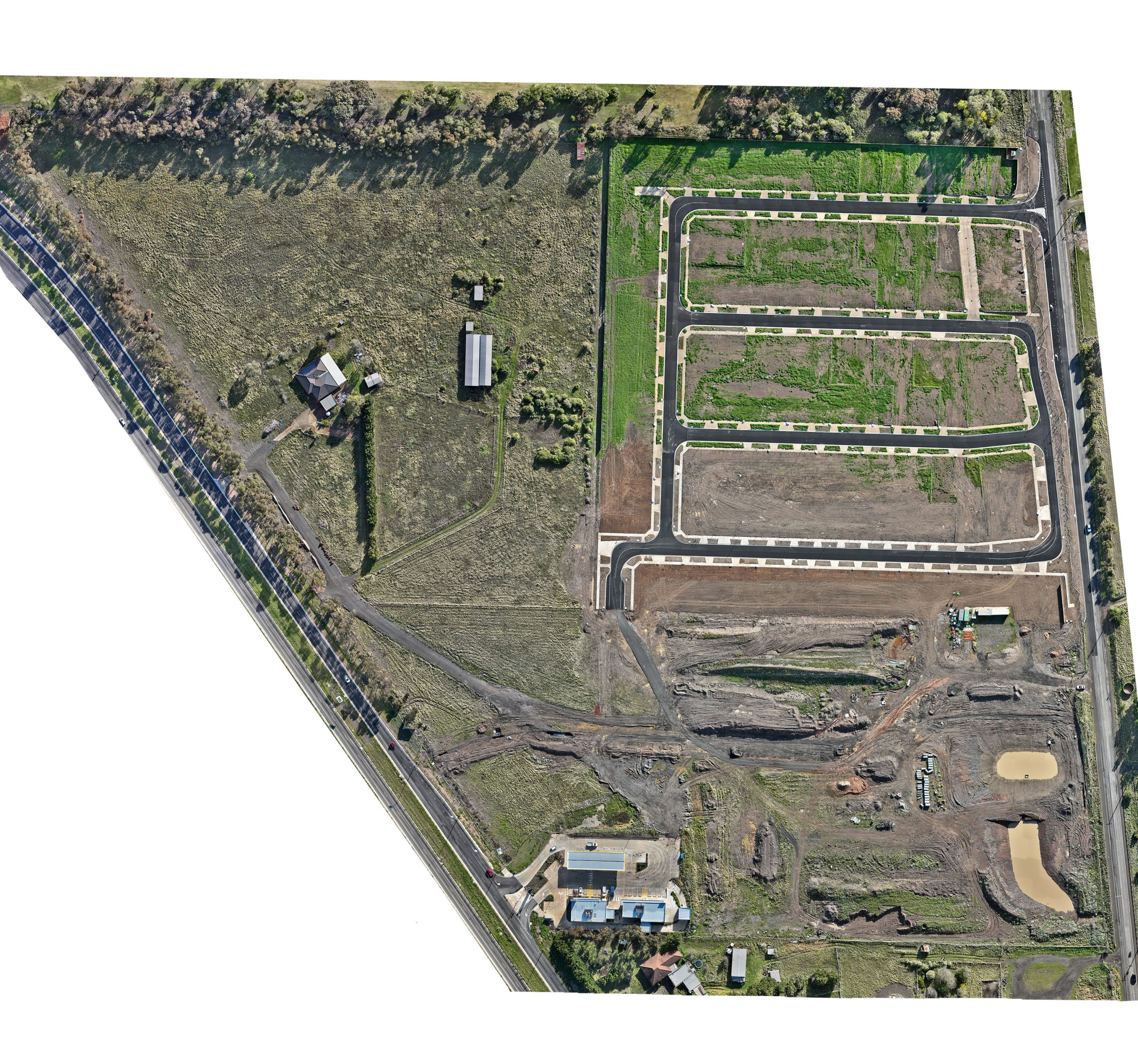
Executive Summary: This case study explores the innovative application of drone technology to create a 2D orthomosaic map for a construction site’s quarterly report. The study focuses on the process, from planning to execution, and the subsequent impact on the project’s progress tracking and reporting.
Introduction: In the rapidly evolving field of construction, the integration of drone technology has marked a significant advancement in site monitoring and documentation. The creation of a 2D orthomosaic map serves as a pivotal tool for stakeholders to visualize the site’s development with high-resolution accuracy.
Project Overview:
- Location: Victoria, Australia
- Objective: To generate a detailed 2D orthomosaic map for the construction site’s quarterly progress report.
- Technology Used: DJI Mavic 3 Enterprise with high-resolution imaging capabilities and sophisticated mapping software.
Challenges: The primary challenge was to capture comprehensive aerial data of the construction site, which spans a considerable area with varying topography and ongoing activities.
Methodology:
- Drone Selection: DJI Mavic 3 Enterprise – an enterprise-grade drone with a high-resolution camera was chosen for its stability and image clarity.
- Flight Planning: A systematic flight path was designed to cover the entire site, ensuring an 80% front and side overlap between images for precise stitching.
- Image Capture: Multiple flights were conducted to capture a series of 2,900 images at different altitudes and angles.
- Data Processing: The images were processed using advanced software to create a seamless orthomosaic map, correcting for any distortions and ensuring scale accuracy.
Results: The 2D orthomosaic map produced was of exceptional quality, showcasing intricate details of the construction site. It provided a comprehensive view of the site’s current status, including structures, materials, and terrain.
Impact: The orthomosaic map significantly enhanced the quarterly report, offering a clear and detailed visual representation of the site’s progress. It facilitated better decision-making, improved communication among project members, and served as a reliable document for future reference.
Conclusion: The successful implementation of drone technology for creating a 2D orthomosaic map has demonstrated its value in construction reporting. It has proven to be a cost-effective, time-efficient, and accurate method for site monitoring and documentation.

Why Choose Us
Dave shoots for Speed Media Image Agency, a professional photo agency providing coverage of all sports, events and photojournalism. We photograph for international, national and local media agents, including Getty Images, Icon Sportswire, AP, News Corp, The Times, ESPN and CNN. We have a team of commercial photographers ready to shoot for sport teams and sponsors.


